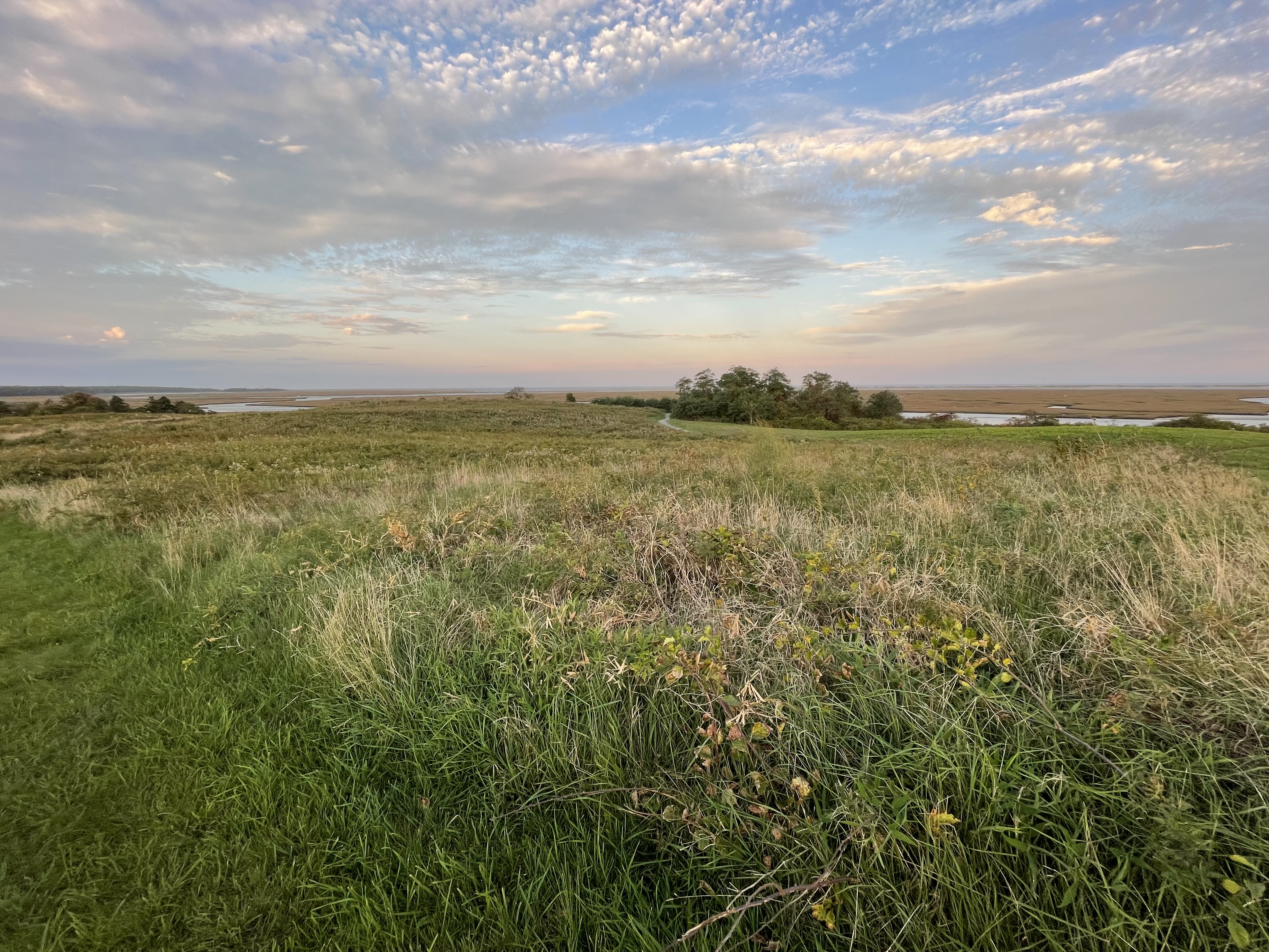
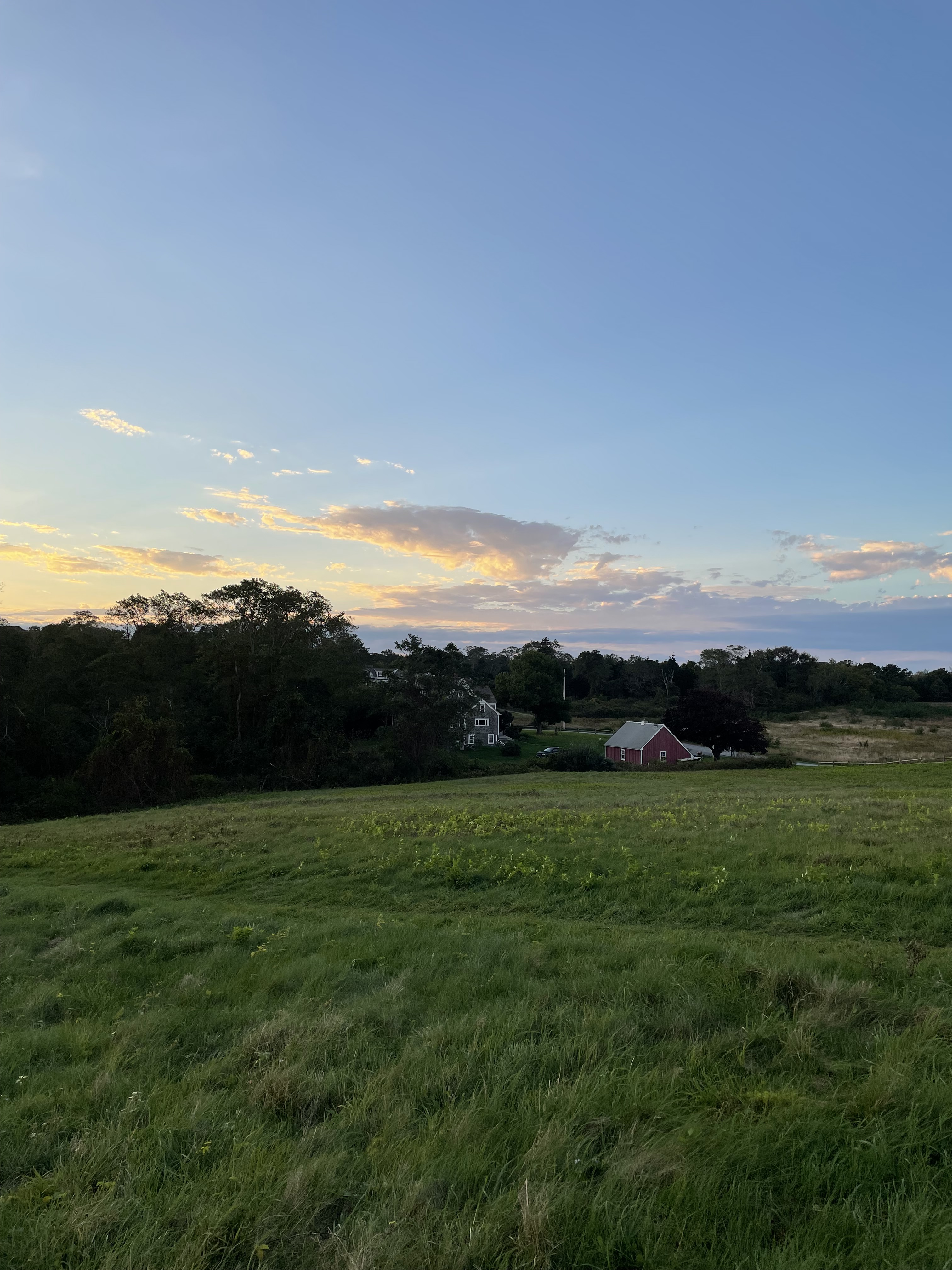
Sunset looking toward Nauset Marsh, 16 October 2021.
Last night, on my way back from Stop & Shop in Orleans, I stopped at Fort Hill at sunset. Fort Hill is one of the few parts of the National Seashore my parents never took me. For decades, it was only a sign on Route 6 right after the Orleans Rotary — a place after a long commute from Providence or, as a child, an even longer drive from Connecticut, I never wanted to dally. When I first decided to stop, about a decade ago, I was blown away. It’s an extraordinary tract of tremendous natural beauty and layered with history. Recently, I learned its imminent development was the catalyzing force for finally passing the legislation to create the National Seashore.
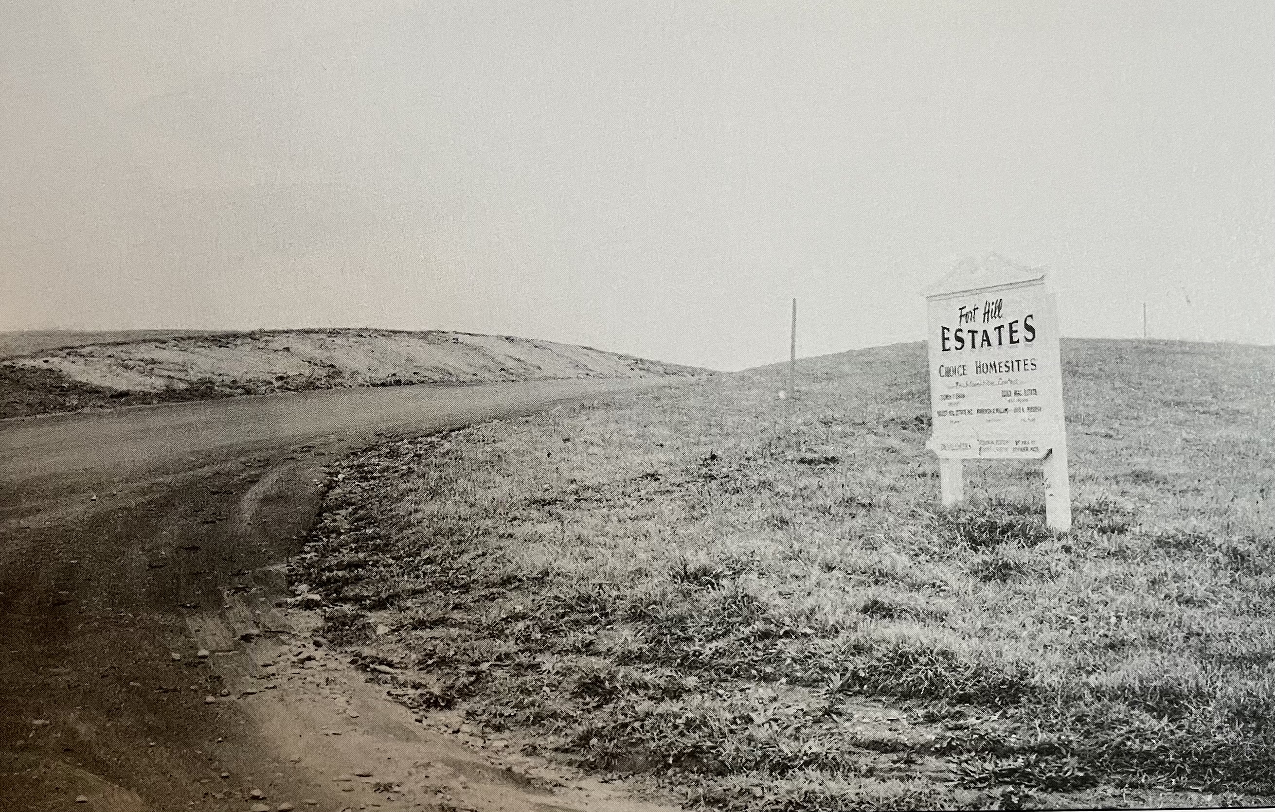
For at least 8,000 years, the Fort Hill Area was extensively utilized by the Nauset tribe of the Wampanoag federation. In 1644, when Europeans began colonizing Nauset land, they built their first meeting house at Fort Hill. As the highest point in the area, it was thought to be defendable — although there’s no evidence that they ever built an actual fort. Starting in 1742, the area was owned by the Knowles and the Penniman families. Daniel Lombardo in Cape Cod National Seashore: The First 50 Years states that “…the Fort Hill Area was purchased in 1960 by Mel-Con, a development company that began laying out roads and planned to divide the property into 33 lots. The formation of Cape Cod National Seashore discontinued development. The Nauset Moors Farm House (Knowles House) is the only part of the property that remains in private hands.” (p. 51)
From National Seashore Archive via Daniel Lombardo’s book.
While the first serious proposal to establish the Cape Cod National Seashore had been developed by the National Park Service in 1939, it had been stalled by World War 2 and the lack of National Park funds after the war. In the late 1950s, competing bills were introduced to Congress, which further slowed the progress. It’s worth noting that Cape Codders — at least as expressed by elected officials — weren’t in favor of the project. There was a belief that a lot of money could be made through development and tourism.
Lombardo also writes: “In April 1961, it was clear that the only way to break through the fog of inaction was to organize land and air tours of the Cape for officials and townspeople to see for themselves what was at stake. Senator Leverett Saltinstall’s assistant Jonathan Moore said, ‘It was a glorious trip. We flew low over Nauset Marsh and landed at one point on Fort Hill, and we were standing there, arguing about whether Fort Hill should be in the park or out of the park. It was still up for grabs. A subdivision had been laid out, and there were even some stakes outlining a couple of homes.’ Senator Alan Bible said, ‘That decided it for me.’” (p. 7)
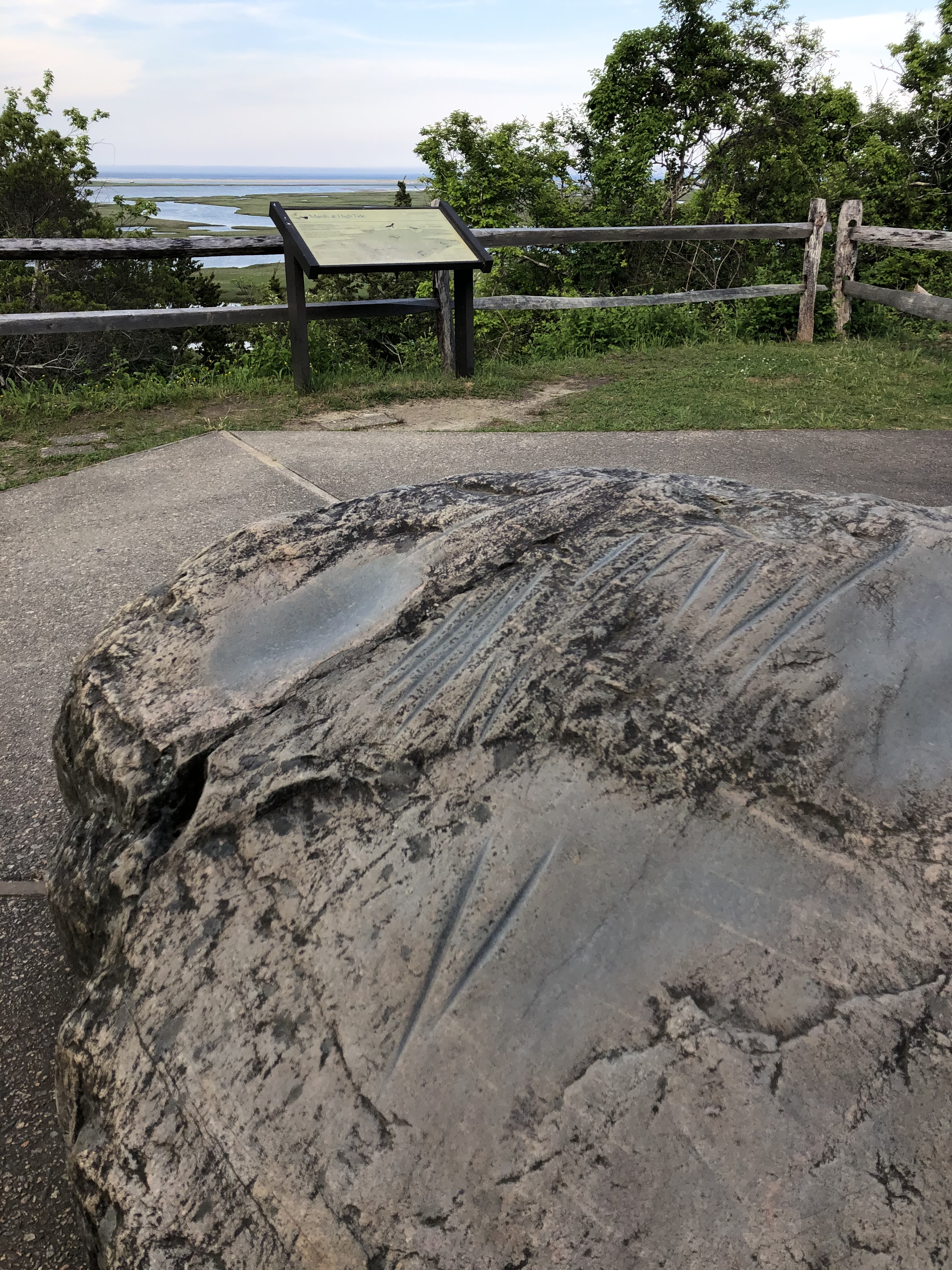
‘Indian Rock’ with historic marker, summer 2020.
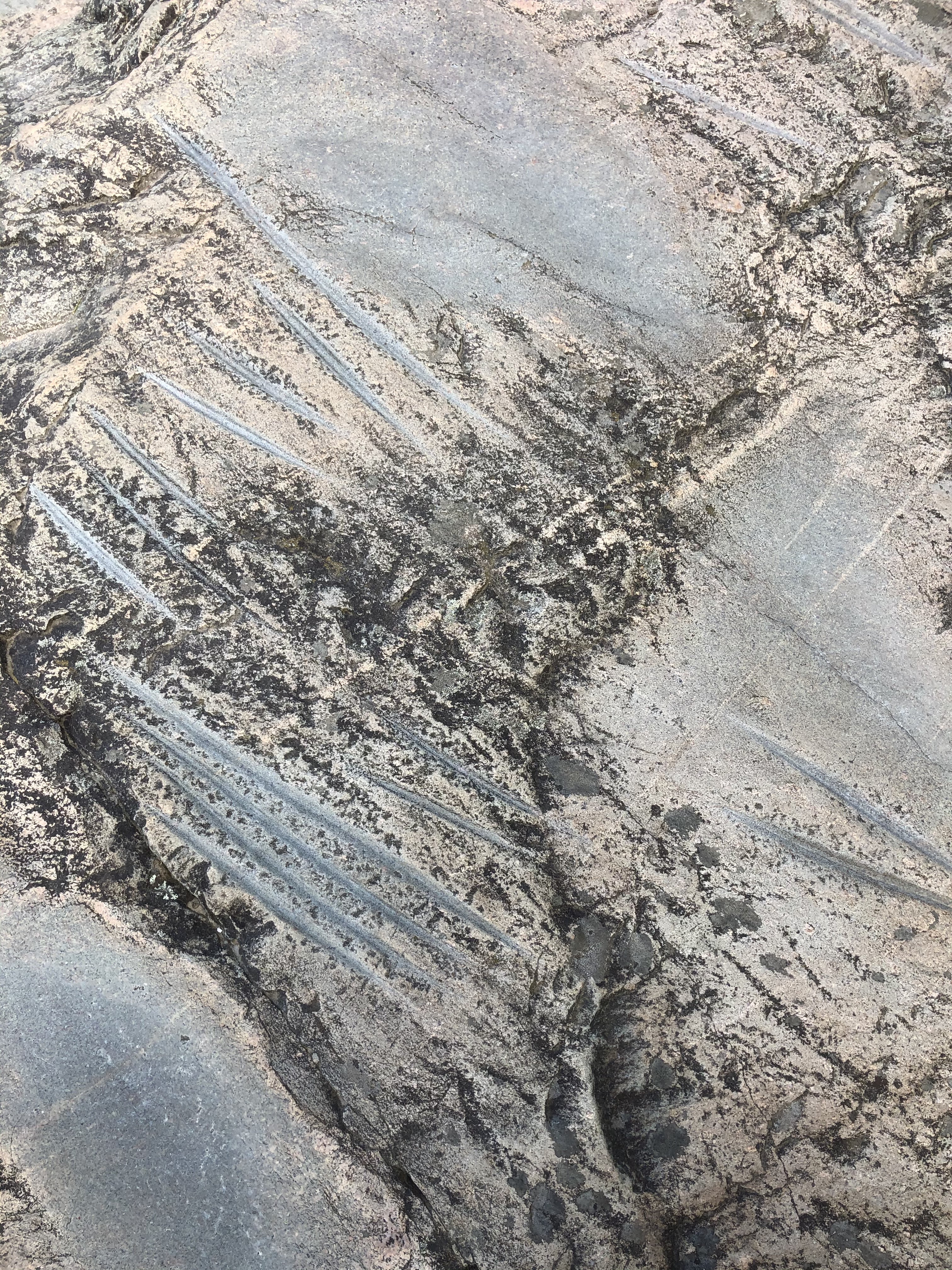
Grinding marks on the rock.
Evidence of pre-European indigenous presence on Cape Cod usually takes a sharp eye. An exception is ‘Indian Rock’ at Fort Hill. The Nauset people used this rock to grind, polish and sharpen their tools made of stone and animal bones, as well as shape their fish hooks. The rock was originally in another location nearer the marsh. The National Park Service moved it in 1965 when the National Seashore first opened.
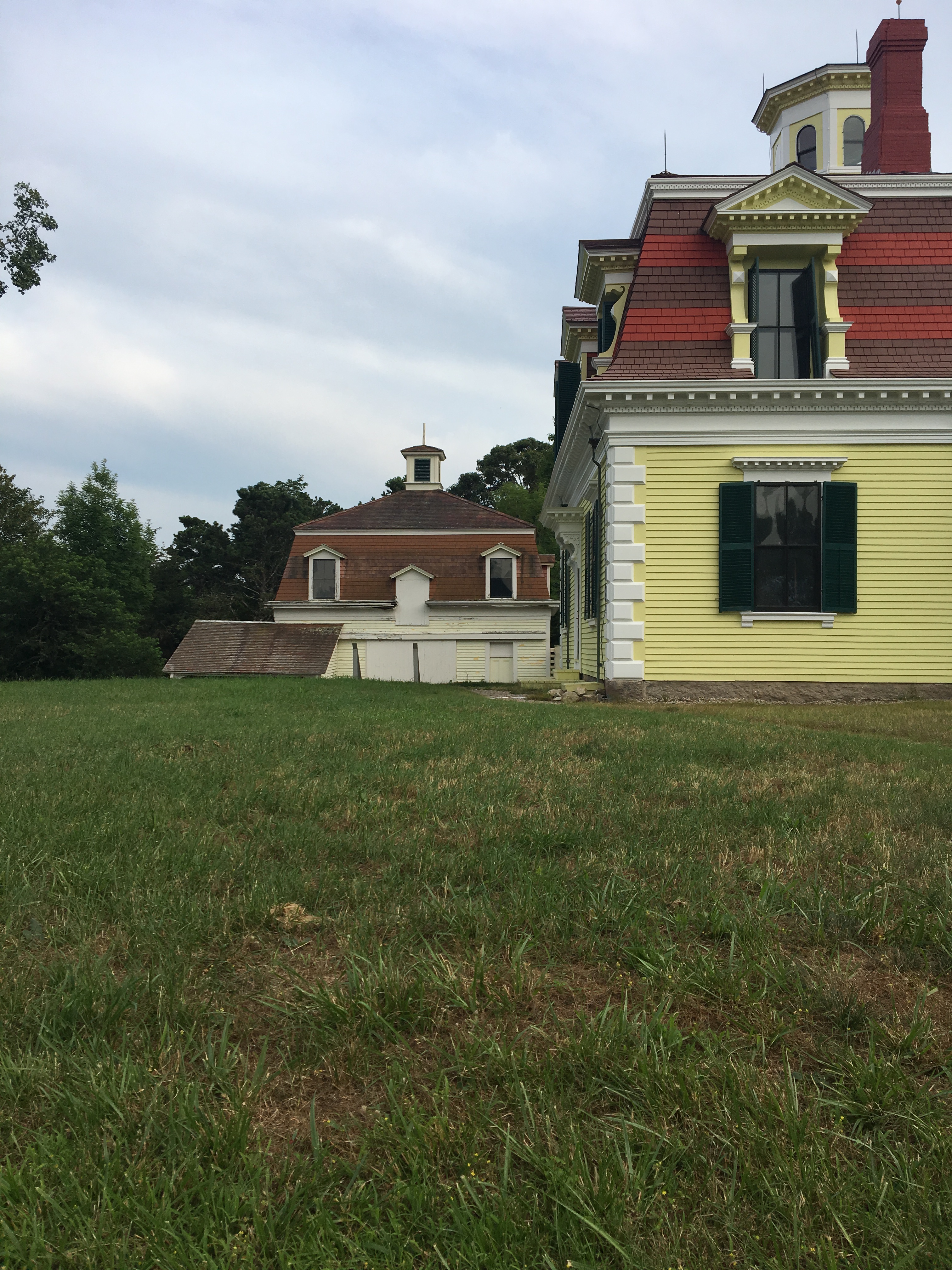
Penniman House in summer 2017 as barn was being renovated.
Captain Edward Penniman (1831–1913) was a whaler. By age 29 he was captain of his own ship, and when he retired in 1868, he built this French Second Empire-style house adjacent to the Knowles farm. Penniman’s descendant, Irma Knowles Penniman Broun (1908–1997) — an ornithologist and conservationist, — sold the Penniman estate to the Cape Cod National Seashore. It was added to the National Register of Historic Places in 1976.
Looking west toward Nauset Moors Farm House (Knowles House).

I like the Red Maple Swamp Trail a lot, but there can be mosquitos.

In the late spring, the southeastern field of Fort Hill has an abundance of lupine. It’s glorious.
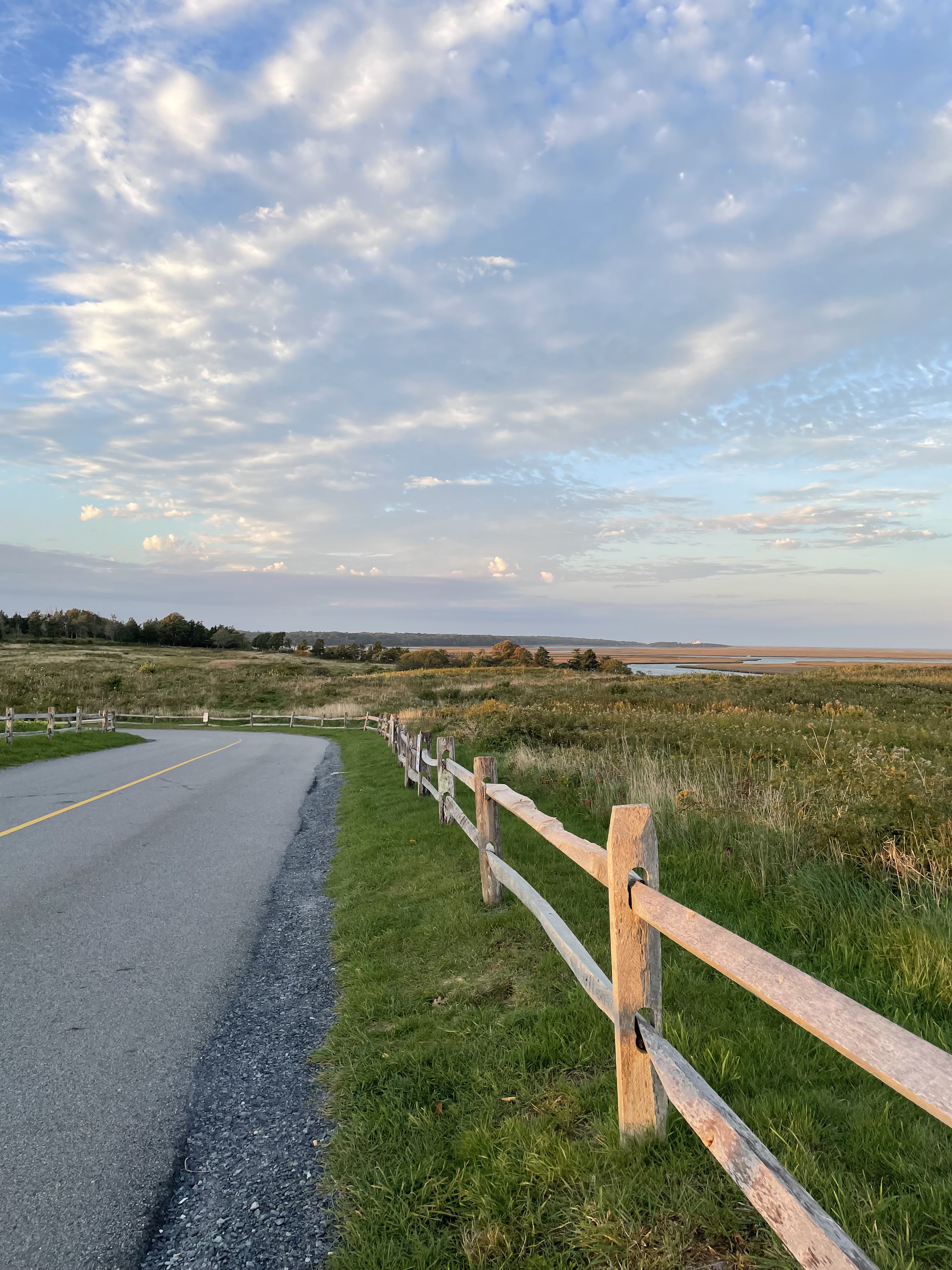
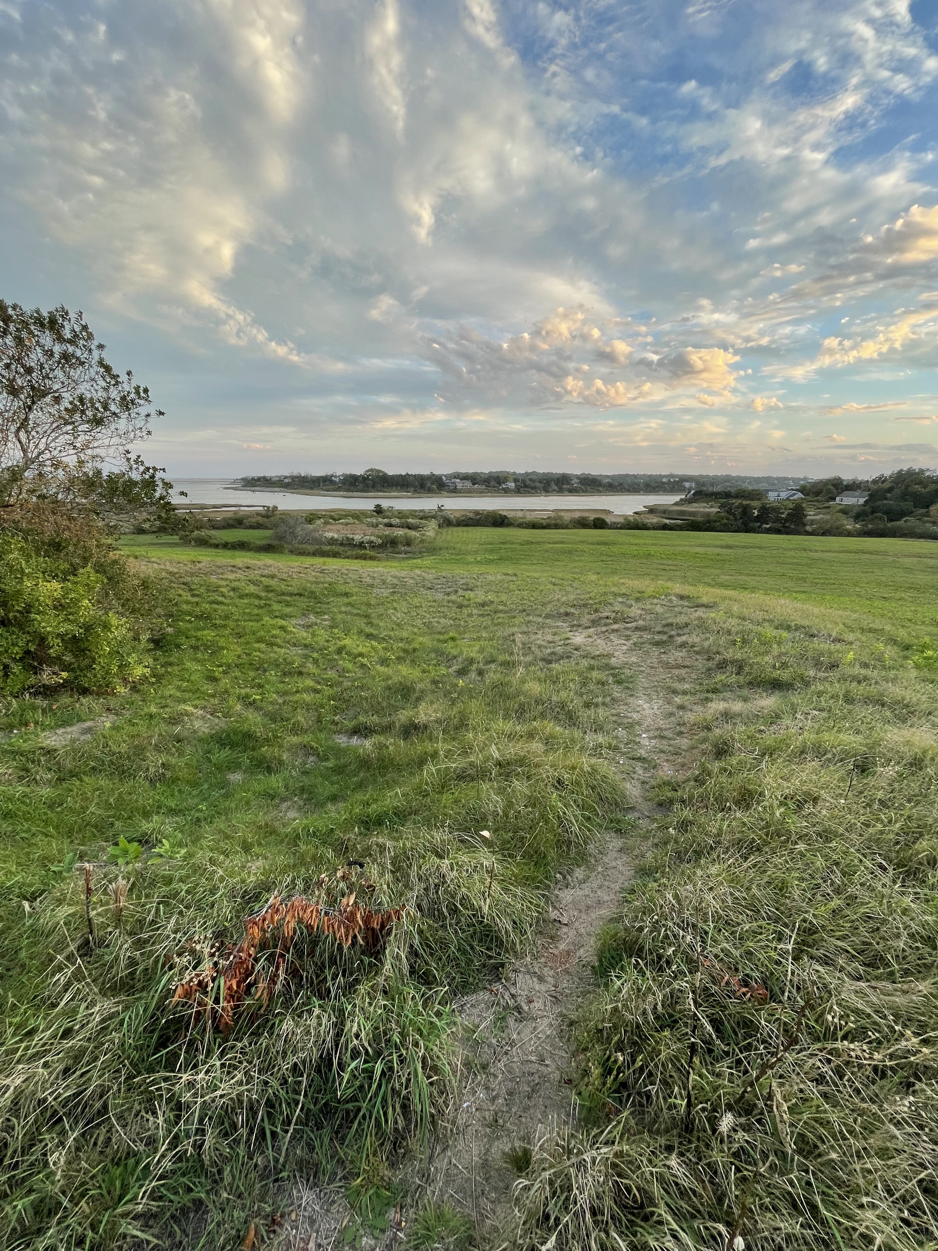
More sunset photos from 16 October 2021
______________
Field Guide: Walking & Painting on Cape Cod is a fundraiser to support Provincetown Commons’ artist studios, co-working facility, meeting spaces and exhibition gallery. Please donate at our website: https://www.provincetowncommons.org/fieldguide-walkingandpaintingcapecod

Funny, same with me, in terms of spending time in Wellfleet for over 40 years before I actually went to Fort Hill. Think I learned about it from other artists, and have now painted there a number of times. Did not know the history connection with the National Seashore, interesting, thanks.
LikeLike
I had a similar experience. Living in Brewster and driving to Welfleet/Truro/Ptown—I just wanted to get there and passed by the Fort Hill sign. Several years ago I finally stopped. The natural beauty and bit of conserved history still inspires!
LikeLike
It’s funny how we think about distance on Cape Cod.
LikeLike